
road work
2019
Inspired by the work of Erin Davis, I set out to investigate the relationships between street nomenclature and spatial logic in the cities that hold personal significance to me. This project is part urban analysis, part linguistic mapping, and part personal cartography.
Where previous spatial work of mine had been grounded in visual programming environments like Grasshopper and Rhino, this investigation required a tool better suited for handling large-scale, city sized datasets. Enter R, a statistical programming language that opened up entirely new workflows. With it, I could parse, filter, and visualize data at the scale of entire metropolitan regions, something previously out of reach.
Using city and county level GIS datasets, I plotted the street maps, color coding each line segment based off what type of road it was: road, street, drive, parkway, etc… Some cities showed rigid grids and directional logics; others displayed meandering paths, topographically based.
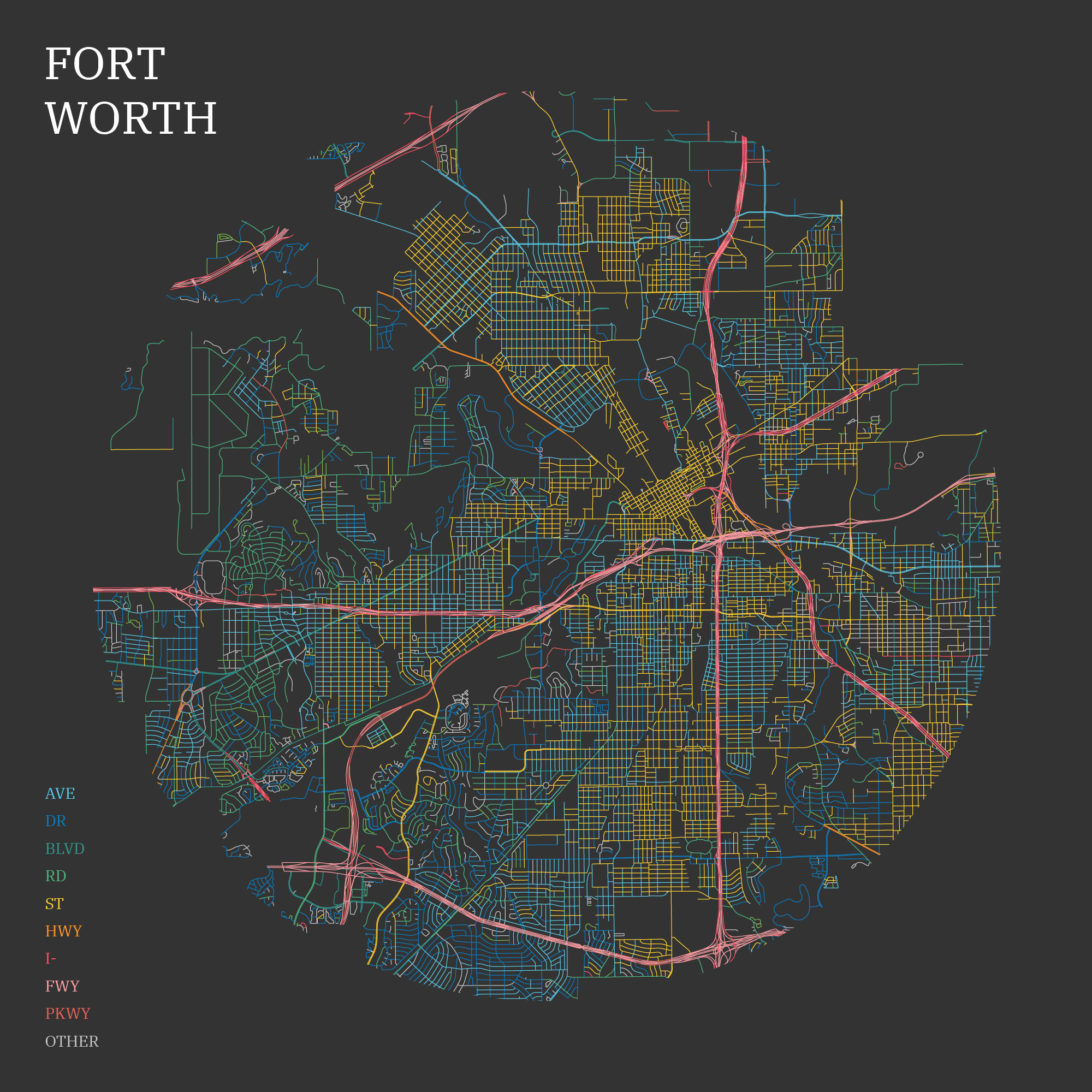
I began by focusing on specific cities with personal relevance, starting with my own current home of Fort Worth, Texas. Despite having lived here for over four years at the time (and working downtown), I hadn’t noticed that downtown Fort Worth is comprised entirely of streets. Not a single avenue. Just streets.
Moving outward from downtown into the city’s early residential neighborhoods, a rhythm begins to emerge:an alternating pattern of streets and avenues, echoing the city’s gradual expansion and layered growth. The naming conventions serve as quiet indicators of time and intention, older planning logic fading into newer, less rigid naming schemes.
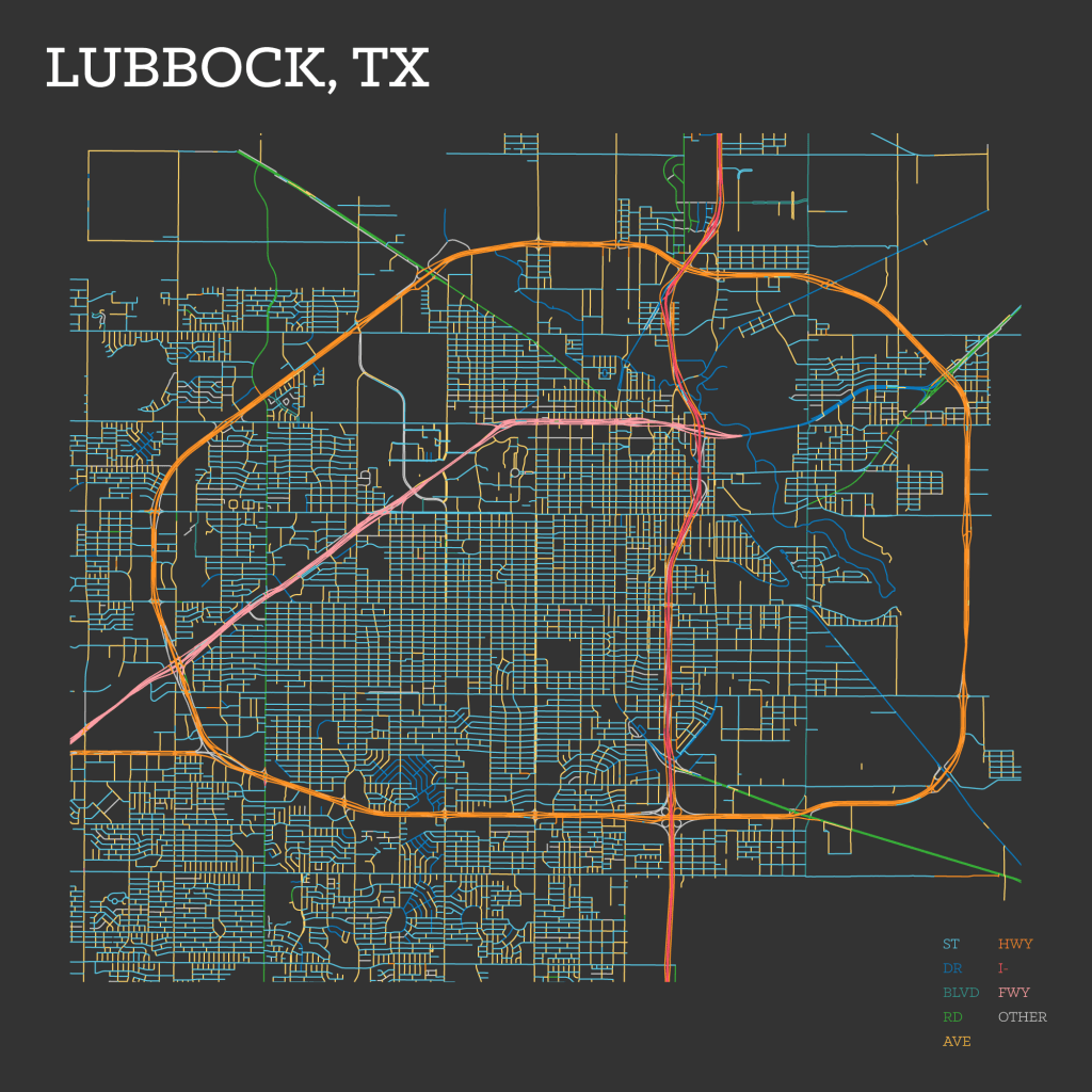
Next, I looked at Lubbock, my home during college. It is a place with a strong grid-based identity. Lubbock’s layout is uncompromisingly orthogonal, thanks in part to the flat, open terrain of the Llano Estacado. There, a consistent system prevails: avenues run north–south, streets run east–west. The underlying geometry is pure Jeffersonian grid: efficient, rational, and legible.
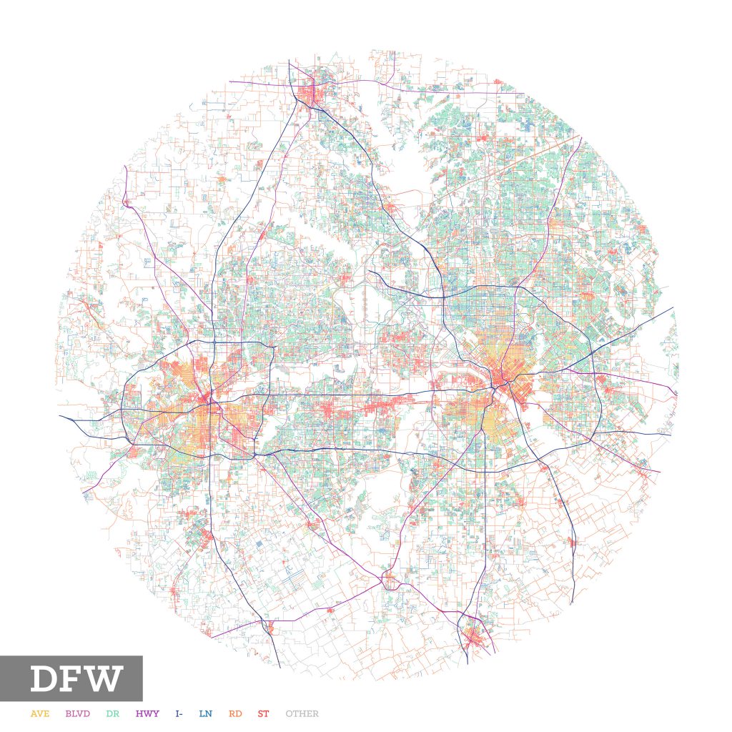
Zooming out to the broader Dallas–Fort Worth metroplex, a wider trend becomes apparent: while historic city centers maintain a blend of street and avenue designations, the suburbs are dominated by drives. The repetition is striking: drive after drive populating the residential sprawl. It raises the questions: are drives just more marketable? Is there something less desirable about living on a street or avenue? These naming choices subtly encode perceptions of place.
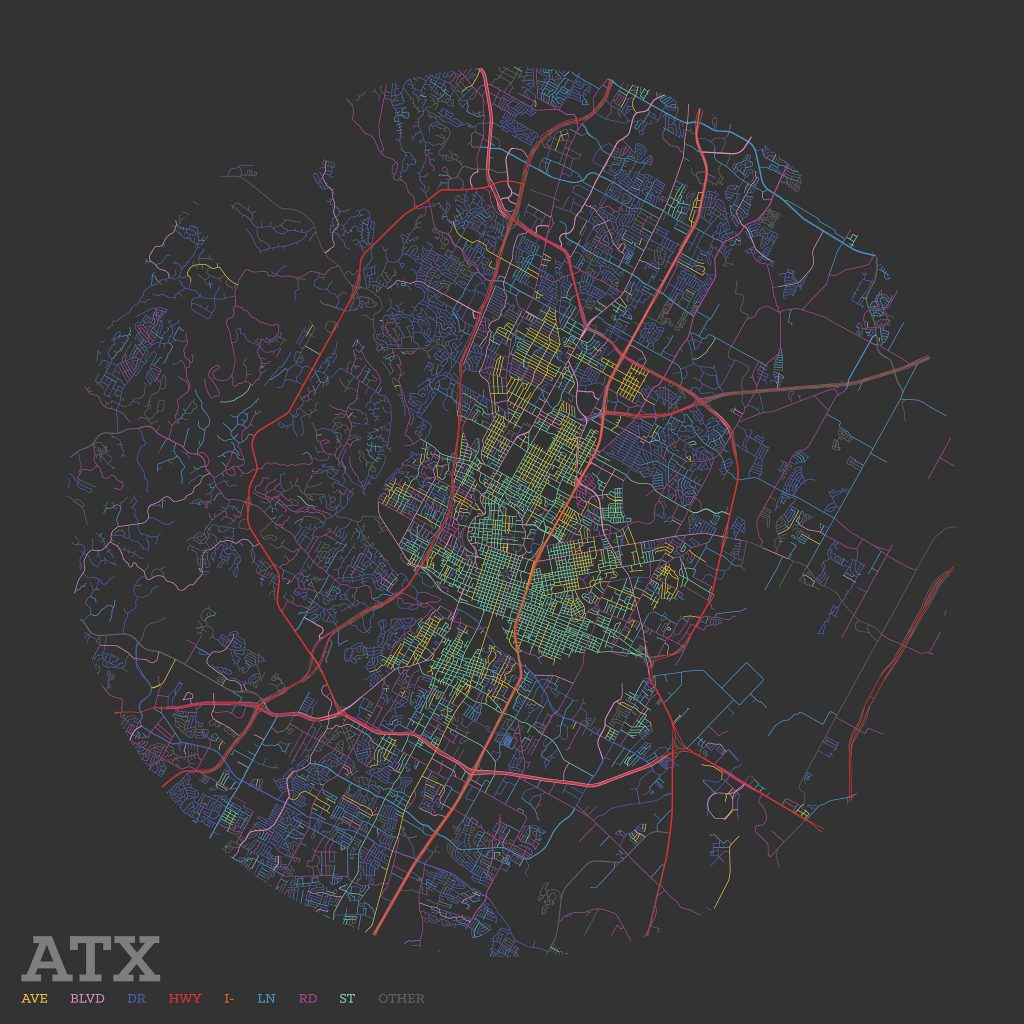
I also looked at Austin at the behest of a friend. What stood out immediately was the organizational shift between the downtown grid and the western neighborhoods like Barton Hills and Rollingwood. There the rigid geometry gives way to curves and cul-de-sacs, shaped by the topography of hills, creeks, and bluffs. And as with DFW, the pattern holds: residential zones favor names like drive and road over street or avenue.