a home for…
2019
After reading a New York Times article on the outsized role that zoning plays in shaping America’s housing landscape, particularly the scarcity of multi-family housing, I became curious about how that story plays out in the two cities I’ve called home the longest: Lubbock and Fort Worth.
Using open zoning and building footprint data provided by each city, I built a set of custom visualizations in R to map and color-code every lot by residential zoning type: single-family or multi-family. These maps make visible what many planners, designers, and residents have long felt: our cities have overwhelmingly prioritized land for single-family housing. Especially in Texas, where the promise of a private yard remains a cultural touchstone, cities have grown outward instead of upward, spreading wide across the plains rather than increasing density within.
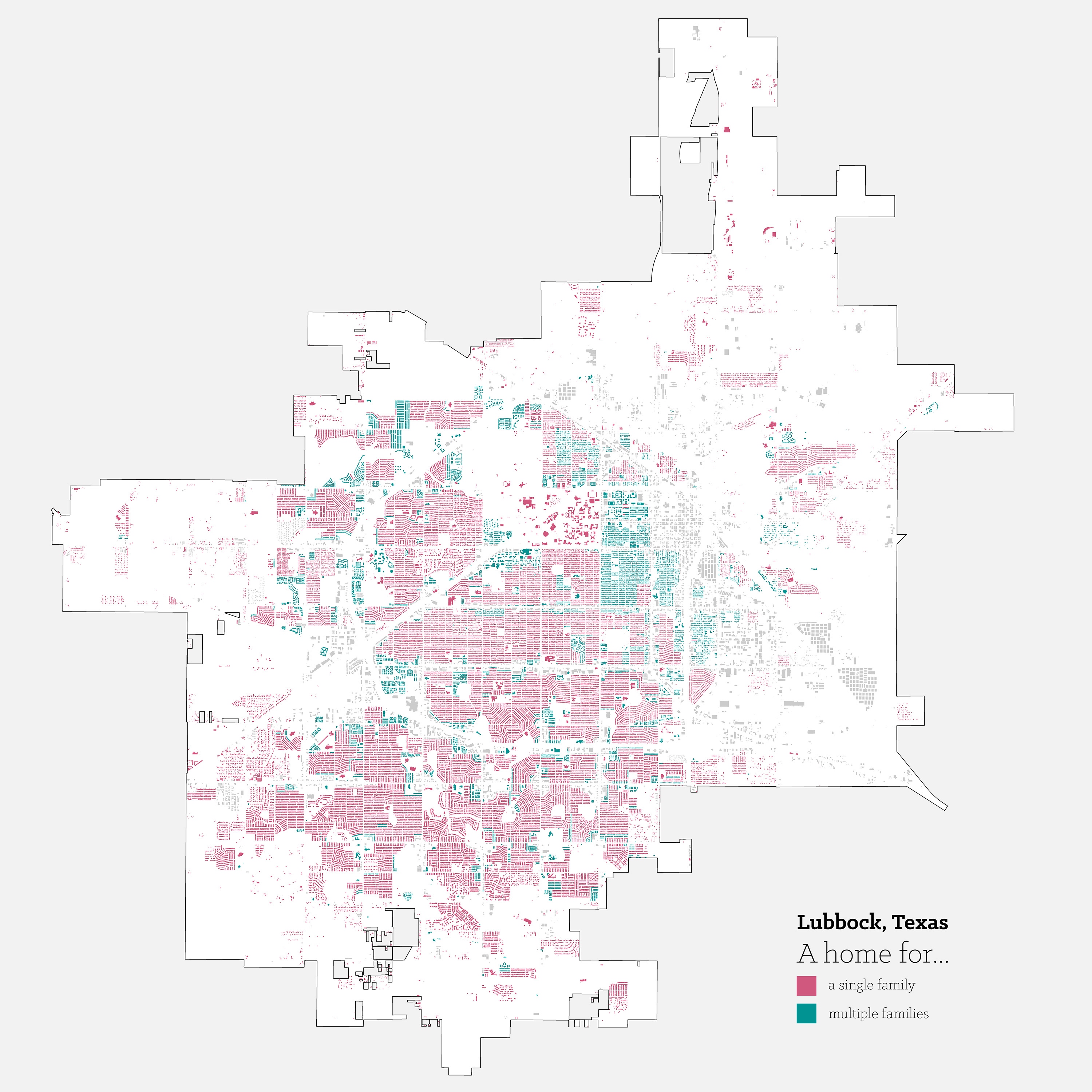
In Lubbock, the pattern is especially stark. The city’s gridded structure emerges immediately, the result of flat, featureless topography that posed no obstacle to linear growth. The zoning map reflects this rigidity. While some clusters of multi-family zoning appear, primarily near Texas Tech University, the vast majority of the city is zoned strictly for single-family use. A few arterial corridors in the southern half of the city show signs of diversified zoning, but as the city continues to grow outward, the sheer footprint of low-density housing is hard to ignore.
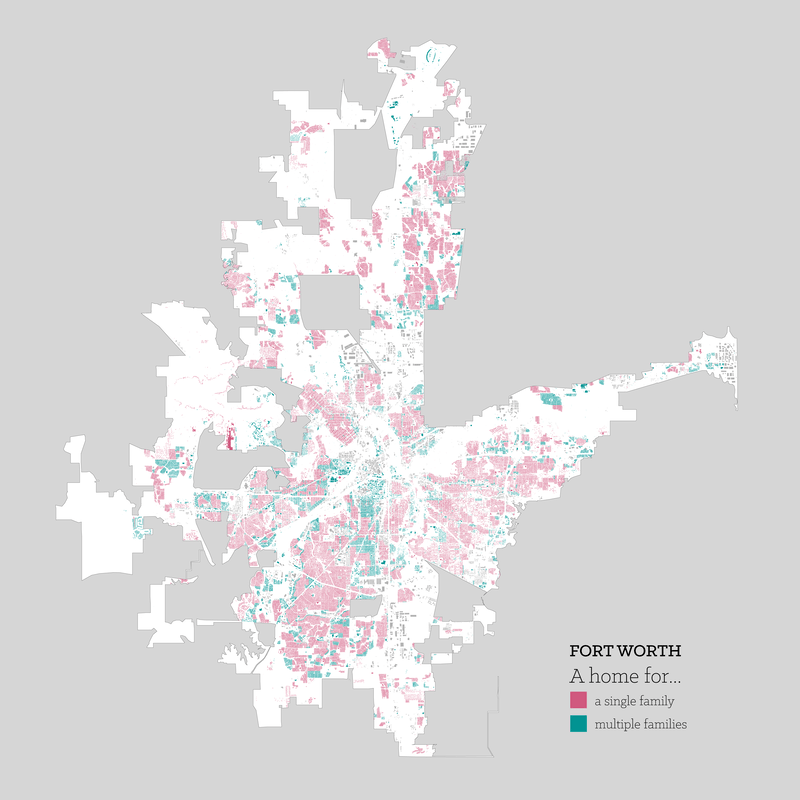
In Fort Worth, the story becomes one of suburban sprawl at scale. The zoning map shows dense clusters of single-family zoning stretching well beyond the core, with limited nodes of multi-family use. However, a closer reading reveals some nuance. Entire neighborhoods, such as Fairmount and the Near Southside, are zoned to allow for medium-density uses like townhomes. But zoning potential and built reality are often out of sync. In Fairmount’s case, the neighborhood remains composed almost entirely of single-family homes, due in large part to its historic designation, which places strong limitations on redevelopment.
These maps raise important questions about land use, equity, and the future of housing in American cities. Zoning isn’t just policy: it’s a quiet architect of how we live, where we live, and who gets to live there. And when you visualize it at scale, the story it tells becomes hard to ignore.