
1×1 – a view of west texas
2019
Following the Revolutionary War, the fledgling United States faced both a challenge and an opportunity: managing and monetizing vast tracts of land west of the original thirteen colonies. To bring order to this immense territory, Congress passed the Land Ordinance of 1785, establishing what would become the Public Land Survey System (PLSS).
This system divided land into a rectilinear grid, with each township measuring six miles square, further subdivided into 36 square-mile sections. Often attributed to Thomas Jefferson’s vision of rational land use, you may have heard this referred to as the “Jefferson Grid.” This grid came to dominate the physical and cultural landscape of much of the American West, embedding itself in everything from agriculture to infrastructure, and even the way we mentally map space.
Born and raised in West Texas, I grew up between the lines of this framework. My childhood unfolded at some x, y coordinate within a repeating pattern of roads, fallow fields, and ranches. Whether imposed upon the land or adopted as a practical means of navigation and development, its presence is undeniable — both as an organizing system and as a quiet backdrop to daily life.
What follows is a series of aerial scenes from Texas, highlighting how this square-mile grid continues to assert itself across varying contexts: from the sparse rural expanses of West Texas to the denser, planned communities of Plano. (Yes, I know Plano isn’t West Texas — I included it as a deliberate contrast, illustrating how the same base geometry can yield drastically different spatial densities.)
This investigation is part cartographic curiosity, part personal reflection — a visual essay on how geometry and governance have shaped the land, and by extension, us.
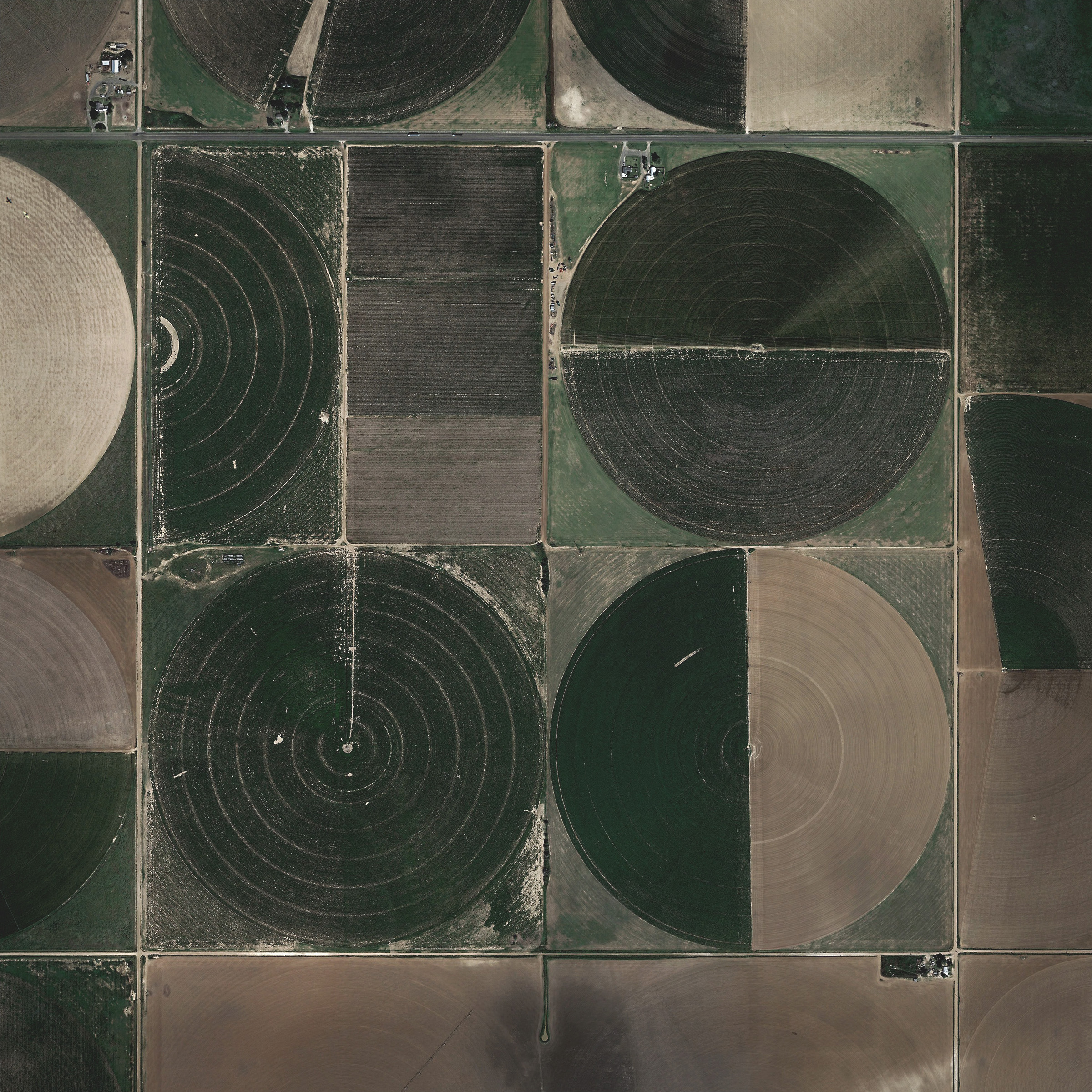
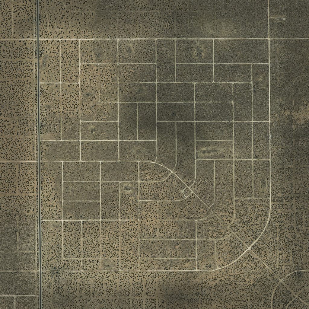
near olton, tx
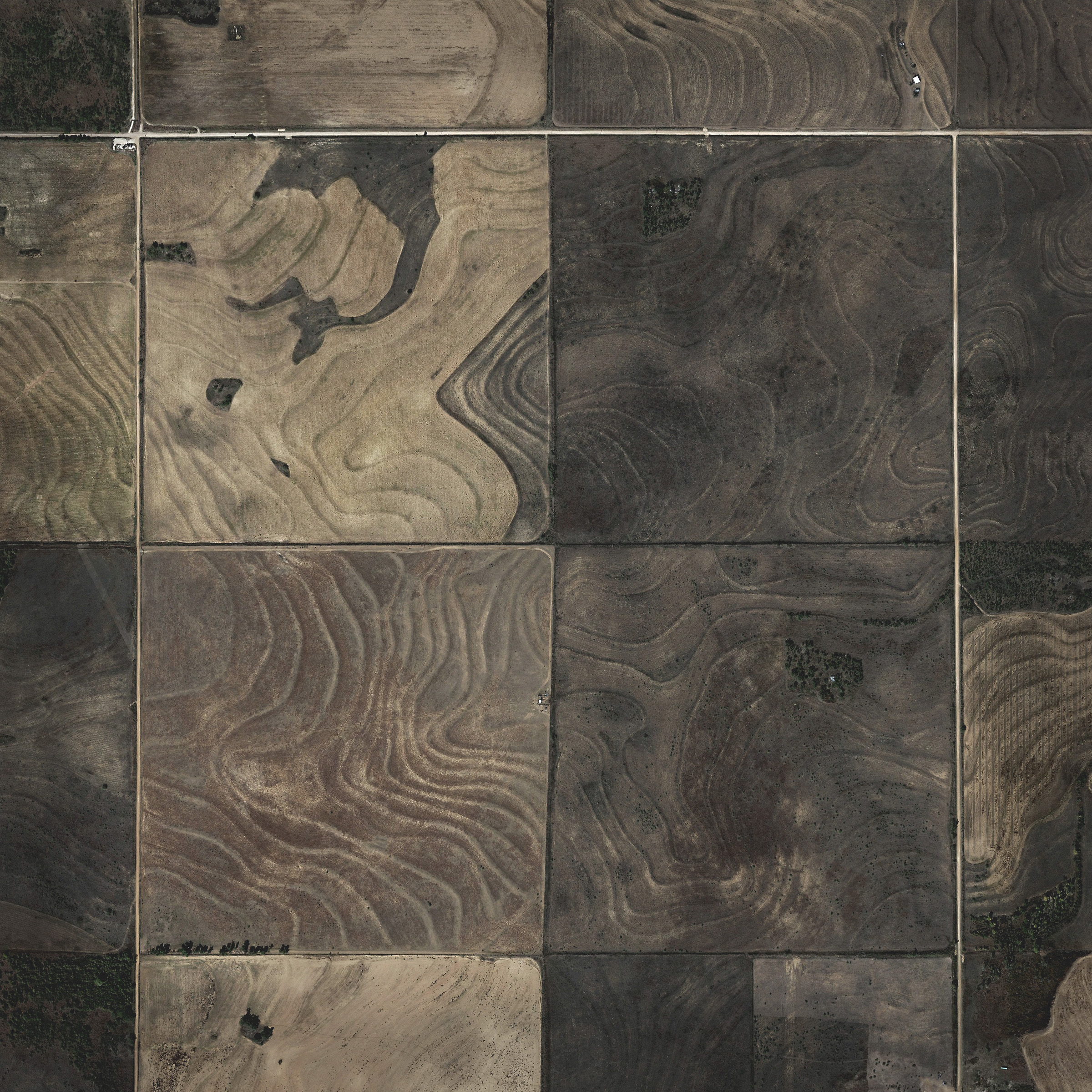
outside of colorado city, tx
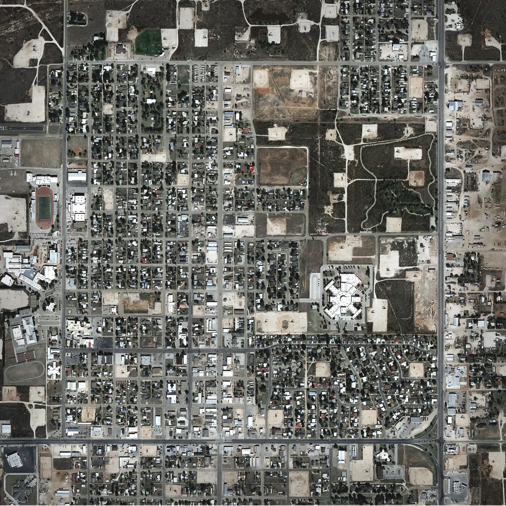
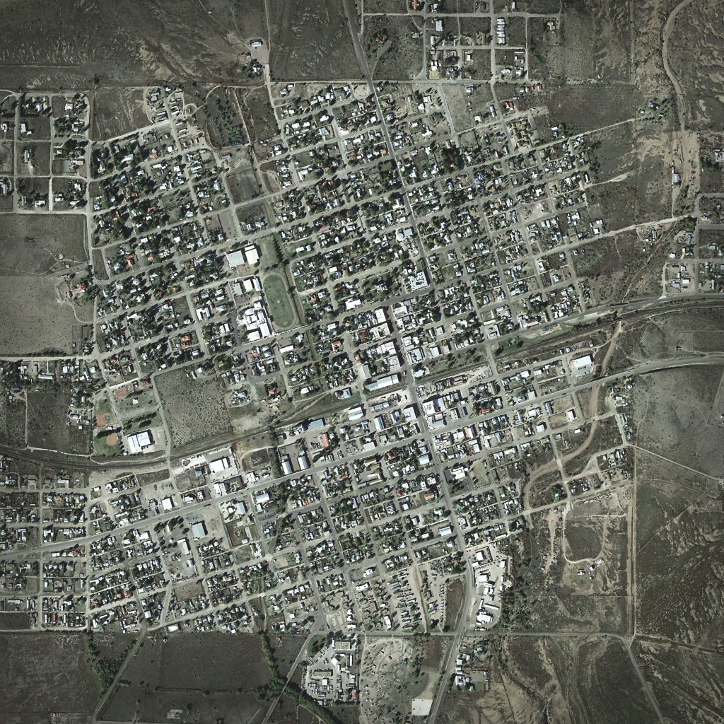
priorities in denver city, tx
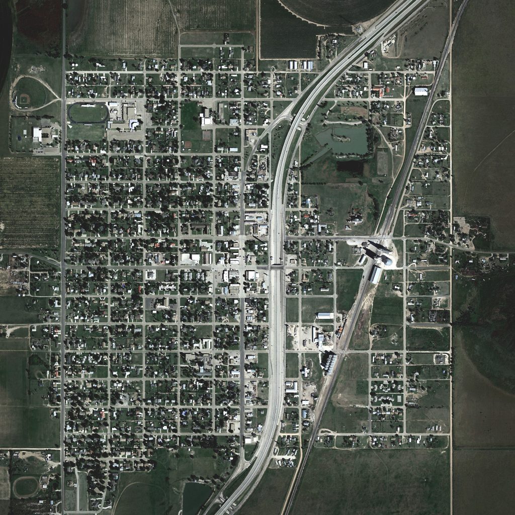
hale center, tx. in this case, the town came first and the highway had to respond to the town’s grid.
a planned development in horizon city, tx
marfa. tx. in this case, the railroad was constructed prior to the town being laid out, and so the town was constructed in right angles aligned to the tilted axis of the railroad.
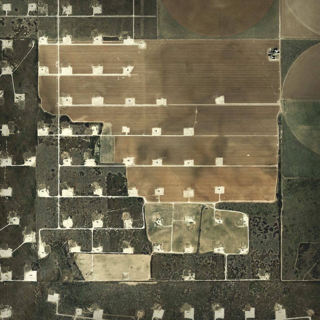
well sites near slaton, tx. a tighter grid of well sites pockmarks the landscape, interfering with the jefferson grid.
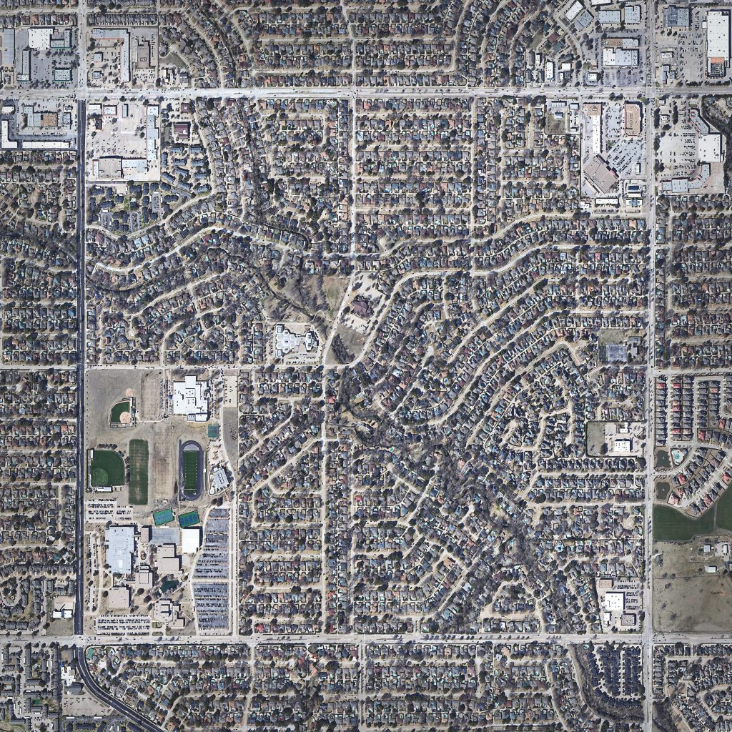
a square mile in plano, tx. included purely for the contrast in density.